


Trainsity Kuala Lumpur LRT KTM
Mô tả của Trainsity Kuala Lumpur LRT KTM
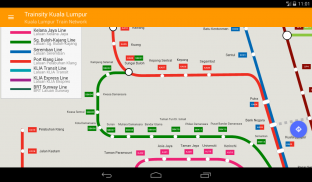
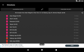
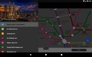
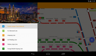
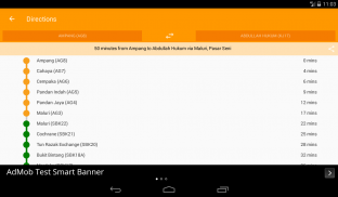
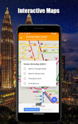
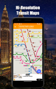
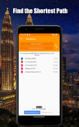
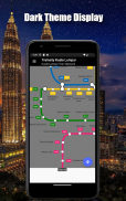
Tìm đường đi quanh thành phố Kuala Lumpur bằng các bản đồ vectơ có độ phân giải cao của các đường KTM Komuter, đường RapidKL và đường liên kết đường sắt KLIA Express, bao gồm đường BRT Sunway. Các bản đồ có dấu chân kích thước tệp nhỏ nhưng có nhiều mức thu phóng và có thể hoạt động ngoại tuyến mà không cần kết nối với Internet. Người dùng có thể nhấp vào nhãn ga tàu để mở Google Maps hoặc Chế độ xem phố, nơi họ có thể sử dụng tất cả các chức năng của ứng dụng Google để trực quan hóa khu vực xung quanh và / hoặc thực hiện định tuyến cho chỉ đường. Ngoài ra còn có một chức năng ngoại tuyến để tính toán cách tốt nhất để đi từ trạm này sang trạm khác với sự cố và thời gian định hướng (có thể thay đổi theo thời gian di chuyển thực tế).
* Bây giờ với chế độ tối
Trainsity Kuala Lumpur LRT KTM - Phiên bản 2.10.0
(15-01-2025)Trainsity Kuala Lumpur LRT KTM - Thông tin APK
Phiên bản APK: 2.10.0Gói: com.dom925.trainsity.kualalumpurPhiên bản mới nhất của Trainsity Kuala Lumpur LRT KTM
Phiên bản khác


Ứng dụng cùng danh mục

Bạn cũng có thể thích...


